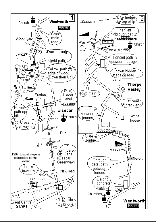
An indication of the first two of 16 stripes of the Round Rotherham route map, from the 1998 version.
Unfortunately, shading has been lost, losing houses, fields, distance markers - and also the route arrows! Also, some text has grown disproportionately during enlargement (necessary to make the map readable), so is not within the bubbles. These problems do not arise on the original, or on the paper version provided on the day of the event.
The full map (for the last year until shortly before the event) is available in .pdf format, but is over 500 kbytes. The Navigation page is modified to indicate status when the .pdf map is updated.